MacBook Down...We're Still Here!

Nearly two months ago, Kimberly and I were living a more simplified lifestyle in the Himalayan hills of Rishikesh, India. Along with a few dozen other wonderful traveling souls, we ate, slept, and drank yoga as we became certified yoga teachers. 

Stories including: the why and what of Yoga Teacher Training, the intense interaction between the monkeys who broke into our bedroom, and Kimberly's first whitewater rafting experience down the holy Ganges River all have their place on this website of ours. Furthermore, during the month of July, we spent a month exploring the vast country of Indonesia with trips to as many of its islands as we could visit. Photos of SCUBA diving with turtles and manta rays the size of car hoods as well as the How-To on hiking Java's most famous volcano for free are in our queue and are eager to be shared...

...except while in India, our MacBook decided to temporarily (we hope) shut down until it can get some TLC back in the USA. (Ironically, there is only one Apple Store in all of Southeast Asia--Singapore, and it has a two week backlog for any repairs.) Updating a website while coordinating the final leg of our trip with only an iPad has been a challenge and is the reason our posts have been put on pause. 

If you're following along, first, thank you for allowing us to share with you. Secondly, we'll be back home in less than a week (hooray!) and look forward to not only seeing everyone in person but to continue story-telling and sharing on this website...so stay tuned.

Day 11 - 14 | Dragnag to Lukla

Day Eleven - Dragnag to Gokyo

Approaching the Ngozumpa Glacier was met with slight confusion as the path down to the glacier bed was difficult to find. To further complicate things, once we finally found the path down to the glacier bed, there was a network of trails to choose from, all made by different guides or local animals. We witnessed one guide take his group to a dead-end, which quickly generated an “Are you even a real guide?” from a disgruntled client. 

Ultimately, all it took was keeping our heads up, sighting the destination (or what we believed to be the destination) on the other side of the glacier, and picking whatever trail took us there. Once to the other side, we faced a second round of challenges when we had to literally run through a section of trail where the wind was causing rockslides from above. At one point, we noticed a two-foot diameter boulder rumbling directly towards us and took cover behind another larger stone until it passed. Indiana Jones Challenge: Complete

The massive dirt mound of Gokyo Ri is an underwhelming backdrop to the beauty of Gokyo Tsho (Third Lake) and the quaint village of Gokyo.

The village of Gokyo is known for its green-blue glacial lakes. Sacred to the Nepalese, the alpine lakes are crystal clear and serene. With a lake view, we found a bakery that a few trekkers on the trail had recommended and ordered a chocolate doughnut the size of Kimberly's head. As our doughnut warmed in a large toaster oven, the gentleman added a few sun-dried cow patties to the dining room’s stove for heat. As in the rest of Nepal, his hands weren’t washed before serving our doughnut. Unfortunately, most instances like this we've had to grow accustomed to here in Nepal...sigh.

That afternoon, we debated a hike to the nearby peak of Gokyo Ri for sunset but the doughnut overpowered that desire and a long nap took precedence. The nap was a blessing in disguise as we woke to yet another afternoon snowfall. In the evening, our card games of Vietnamese Poker and Hearts continued with Ruben and Lisa until we saw some porters playing a different game with the owner of the lodge and we inquired how to play. The game was called "Call Break" and was similar to Hearts but with aggressive table slapping involved. We all picked it up fairly easily and played well into the night. 

Day Twelve - Gokyo to Dhole

This morning, I woke up at 4:30am and climbed Gokyo Ri (5,357m/17,575ft). “Because it was there” came to mind as to why I did so, but it didn’t move Kimberly the same-- she stayed in bed. The air was cold, the climb was a solid 45 degree angle, but three hours later I had summited the peak and was back down for breakfast. Both Gokyo Ri and Kala Patthar have wonderful views of Everest and the Himalayas. From the top of Gokyo Ri, you can see four of the highest six peaks in the world. 

Looking South from the summit of Gokyo Ri. Bottom left, the village of Gokyo between Ngozumpa Glacier and Gokyo Tsho (Third Lake). Neat fact: Ngozumpa Glacier is the longest glacier in Nepal.

Looking South from the summit of Gokyo Ri. Bottom left, the village of Gokyo between Ngozumpa Glacier and Gokyo Tsho (Third Lake). Neat fact: Ngozumpa Glacier is the longest glacier in Nepal.

Our hike to the village of Dhole was mostly downhill with a strong headwind giving us our only resistance. The air, fortunately, kept getting easier and easier to breathe and the cloudless sky gave us awesome panoramas and vista viewings.  The village of Dhole was nearly vacant as we searched for a recommendation from our host back in Gokyo. Once we found the particular lodge, we quickly realized we were the only trekkers staying there… maybe the only trekkers in the entire village.

There's no right or wrong path... but at altitude, the one with the least resistance is favorable.

Making small talk with a few of the lodge’s personnel, we were soon joined by a gentleman that was introduced as the owner and who offered us a tongue-numbing pancake as an appetizer before our dinner. My best effort to describe this dish would be a large pancake, first coated in a quarter-stick of butter once it arrived to the table. After the butter melted, it was topped with marinated green chilies and finally, to numb your tongue, garnished with a few pinches of timur (Szechuan pepper). This was the owner’s “favorite dinner,” a self-proclamation we fully believed after watching his staff bring him seven, one by one as he finished the prior.

Once the post-dinner conversation had lessened and our lungs couldn’t handle anymore of the kerosene and cow patty smoke from the stove, we graciously thanked our hosts and found healthier and cleaner warmth in our sleeping bags.

Day Thirteen -  Dhole to Namche Bazaar

Kimberly and I were surprised this morning by a significant amount of uphill, which we both thought was well behind us. A brief but heavy snowfall conveniently encouraged us to take a masala tea break in a small lodge at the top of a large incline. There, we enlightened a family from Canada that were three days in on some of our lessons learned. As the afternoon cleared, we continued our hike and enjoyed looking to the other side of the valley, seeing our two-week old path and pointing out the now familiar peaks and villages in the distance.

Resting and hydrating as we wait for our lunch in the village of Machhermo.

Kimberly strolls through a pasture on the way to Namche Bazaar. 

In Namche Bazaar, we went back to the lodge where we had stayed prior and “splurged” for an upgraded room ($20), which came with unlimited hot showers… a luxury we hadn’t enjoyed for over a week. Our afternoon was spent back in our favorite spot, The Liquid Bar, enjoying yet another Sherpa documentary, this time with a beer to compliment the popcorn. The crowd enjoying the movie was an entertaining bunch to observe. We joked with each other and guessed where everyone was in their travels, giving such nicknames as "three-dayers" or "thirteen-dayers" based on their facial hair or general appearance.

Day Fourteen - Namche Bazaar to Lukla

Last night I slept terribly, running a fever and shivering and shaking all night. This morning, Kimberly bounced around town getting breakfast and exchanging one last round of currency while I tried to build the strength to get out of bed and face our last day. For the past two weeks, we swore we wouldn’t beat ourselves up by hiking the eleven miles out in one full attempt; however, the uncertainty of our flight the following day (we didn't yet have tickets) coupled with the desire to cross a proverbial finish line sooner rather than later caused us to dig deep and set our course for Lukla. 

Looking down the valley towards Namche Bazaar. The "massive" suspension bridge we crossed on day two can be seen, bottom center, dwarfed by the rising hills. 

As I battled fatigue and fever-like sweats, we descended through the valley. Fortunately, the weather was overcast so I was able to focus on safely getting down at a reasonable pace instead of looking around. After lunch, my strength improved and I could focus on the final few miles to Lukla. Ironically, this day was one of the toughest, even though the majority was downhill-- be it the longer-than-normal distance or the mental and physical drain our bodies had already experienced.  Our energy was replenished by the dozens of new trekkers and groups coming onto the trail with an uplifting "Namaste!" as they passed. (In Nepalese, "Namaste" is not just said while practicing yoga but also used when greeting one another with respect and blessing. Informally, it means "Hello.") 

In Lukla, we went straight to the Tara Air office in an attempt to buy two tickets to Kathmandu the following morning. As I attempted to pay for the tickets with our credit card, I was informed that their credit card machine was not working but the one at the airport was. With initial disbelief, the manager behind the counter proceeded to hand me only his business card, told me we had two seats on the 9am flight, and that I could pay once at the airport. In any other situation, that wouldn't have been enough of a confirmation for me, but at this moment, I shook his hand and we walked away to find a place to relax. 

Our evening was spent reliving stories and going back through photos of the incredible time spent in the mountains. We were relieved to be safely back to Lukla with no injuries and plenty of memories. The next morning, our tickets-by-way-of-business card worked like a charm and after taking off from one of the most dangerous airports in the world, we were on our way to Kathmandu, full of Himalayan happiness. 

Day 8 - 10 | Lobuche to Gorak Shep to Dragnag

Day Eight - Lobuche to Gorak Shep

We awoke in Lobuche to a few inches of fresh snow. At 16,100ft in the Himalayas, I figured this may start to be a frequent occurrence. Warmly in our layers, we started our day by following the foot steps left in the snow by earlier guided groups. Aside from the ever-increasing altitude, the day followed a similar trend to prior days: a couple of miles of gradual incline followed by one ass-kicking mountain pass (this time, Lobuche Pass), followed by an hour or two more of gradual accent along a glacier or ridge.

Lobuche, Nepal

Hiking along with our Slovenian friends, Manca and Luca towards Gorak Shep.

Arriving in the next village of Gorak Shep felt a little different than others. Perhaps a bit more reverend or regal, Gorak Shep feels like the grandfather of all villages. Once the primary Base Camp for Mt. Everest, it now serves as the last hub for visiting the “new” Base Camp (EBC), for climbing Kala Patthar, or for turning around and descending. Geographically, it is the half-way point for most trekkers and is equivalent to a cul-de-sac in the mountains, with sharp peaks towering high all around.

The dirt and black rock hillside of Kala Patthar (left) overlooking the village of Gorak Shep. Base Camp is further up the valley--photo right.

We picked the first lodge we saw, dropped our packs, and went towards EBC. The relatively easy rolling-hill stroll to 17,600ft seemed almost like a pilgrimage as the bright tents in the distance came in and out of view. There is nothing visually exciting about EBC; it's just a hundred or so tents sprinkled about haphazardly in a frozen hell... you can’t even see the peak of Mt. Everest. Perhaps it is this rawness and simplicity that makes the sight and presence of being there so emotionally exciting. Below the intimidating Khumbu Icefall rests a pop-up village of summit hopefuls--amateurs and professionals alike from all over the world, waiting for their window to the top of Earth’s highest.

Everest Base Camp along the fringe of Khumbu Glacier. 

Everest Base Camp, 2017

Everest Base Camp, 2017

A little story about "Trail Angels." Anyone who spends any time in the woods or on trails well-traveled knows that there are people out there with amazing souls who commit random acts of kindness for others; people who enjoy the outdoors helpin…

A little story about "Trail Angels." Anyone who spends any time in the woods or on trails well-traveled knows that there are people out there with amazing souls who commit random acts of kindness for others; people who enjoy the outdoors helping people who enjoy the outdoors. It may be some dry kindling tucked away at a soggy campsite or an extra candy bar from a stranger when you're low on energy. In Annapurna, we met Kati and Katrina, two young ladies from New Hampshire whom we had the pleasure of joining and hiking with for most of our time there. Knowing that we were heading to EBC the following week, they kindly gifted us their extra ClifBars and ShotBloks, two items we always have with us when we hike but couldn't get in SE Asia. Although frozen, we saved our final ShotBlok for EBC and enjoyed them with big smiles and graciousness for our Trail Angels of Annapurna. Thanks again, Kati and Katrina!

An afternoon snow storm had us retreat back to Gorak Shep where I treated myself to plate of fried mac and cheese with vegetables and egg. Over playing cards with all of our trail friends that evening, we discussed our approach to Kala Patthar the next morning.

Day Nine - Gorak Shep to Dzongla

Known for its panoramic views and peak-bagging opportunity, we started climbing Kala Patthar at 6:30am to capture the post-sunrise glory. “Kala Patthar” translates to “black rock” in Nepali and Hindi and it is just that…a hillside of dark colored stone that from a distance, looks like an anthill of pepper in a mountainous range of salt. The climb up Kala Patthar was the most strenuous yet, with every other step requiring a deep and purposeful breath. Our acclimatization paid off as we arrived at the 18,514ft summit two hours later, in tact and smiling. 

The view from Kala Patthar looking towards Mt. Everest (the peak surrounded by clouds). The seemingly higher peak of Nuptse (pano-center) is only because it is three miles closer to this viewpoint than Mt. Everest. For reference, Base Camp is bottom left, above the dark stone hillside.

We spent close to thirty minutes on the top soaking in the views and enjoying a celebratory, albeit frozen, Snickers bar. One year ago, Kimberly and I were wrapping up our last day at our respective places of employment and setting the New Chapter clock to Day One. Now, a year later, we were standing at the highest place we have ever been with an early dawn view of Mt. Everest. It was a wonderful feeling.

One month before her 30th birthday, Kimberly celebrated her 30th country visited on top of Kala Patthar...a new type of "30 before 30." 

Our descent was hard on the knees but had a joyous bounce to it. Our main goal had been accomplished and the beautiful weather was an exclamation point. Upon returning to Gorak Shep, we enjoyed a filling breakfast, packed our bags, and started to head back down the same trail on which we arrived. As the clouds lifted, the hike back became a brand new experience as views which were previously covered by poor weather were open and places where our heads were down sucking air, were now enjoyed.

Kimberly passes a local and his yaks, carrying provisions towards Base Camp. 

Arriving back in Lobuche, we paused to take care of some brief logistical items. Kimberly refueled on masala tea and I enjoyed another slice of apple pie. I also charged the phone (our backup GPS for the trek) and exchanged another $100 with my friend at the bakery. After all of our trail chores were taken care of, we determined that the sky seemed fair enough for a two-hour afternoon hike and bid farewell to our Slovenian friends staying back for the night.

The hike to the village of Dzongla was remote and stunning. Aside from one other hiker who we found--map open and requiring a point in the right direction-- we were the only two on the trail. The landscape reminded us a lot of Iceland; low brush and mossy ground cover painting granite hillsides in absolute isolation. 

Day Ten - Dzongla to Dragnag

If we had to rank our “days expected to be tough while on the EBC trek,” today would’ve ranked top three. We woke before the sun, were the first to eat breakfast, and quickly tried to warm up and prepare ourselves for the 5420m/17,782ft glacier-traversing ascent of Cho La Pass. Although we were treated last night to our first [actual] double bed and en-suite bathroom(1), our room was separate from the main lodge allowing the sub-freezing temperatures the opportunity to chill two of the four sides of our room. It. Was. Cold.

Our day as originally planned: Climb 2,000ft over two miles and descend another three miles to the village of Dragnag. In Dragnag, enjoy lunch and then if the weather is clear, hike a final two miles to the village of Gokyo.

Our path over Cho La Pass is directly in front of us...through the V created in the mountain ridge, center photo.

The morning started innocently enough. No snow the night before meant we easily found the trail and slowly started climbing. The dirt trail turned into rock scramble which then turned into glacier. Some parts of the path were fairly sketchy, requiring Kimberly and I to take extra time and share her trekking poles for support. Crampons would’ve been overkill but slip-on shoe spikes would’ve been helpful as we traversed the ridge line of the icy rocks and snow pack.

Glacier crossing on our way to Cho La Pass. 

I was proud of Kimberly on the glacier. She ignored the visual of water running under the ice at her feet, rose above her initial fear of the glacier crossing, and continued forward. Crossing the glacier and reaching the pass took a little under three hours and was unfortunately the easier part of our day. As we left the 17,782ft pass to start the descent down the other side, what lay ahead was nearly two miles of icy rock scramble. Over this vast area, the trail wasn’t marked, not even with the slightest cairn. Without a clear and compact path, this meant that every step was scrutinized for safety, with some seemingly snug boulders occasionally shifting and sending us down to the ground.

The unforgiving terrain combined with cold headwind and snow flurries resulted in one of our most challenging hikes to date. Three hours after leaving the pass, we arrived at our “lunch village” tired and battered. A big lunch, a host offering a free room, and a look out the window to snow and cloudy skies were all the ingredients we needed to call it a day instead of moving along to Gokyo.

Day 5 - 7 | Tengboche to Lobuche

Worried once more that our next village, Dingboche, might have even less availability than our current, we asked our host last night if he had any recommendations in Dingboche and if he could call ahead and book us a room. He had no problems doing so and made a reservation for “Daniel USA.” Even with this security blanket, we started early as the majority of the day would be a steady uphill climb of 1,700ft over approximately seven miles.

A mani wall splits the trail as we leave Tengboche.

A mani wall splits the trail as we leave Tengboche.

Day Five - Tingboche to Dingboche

The cadence of the villages along the trail today coupled with light snow flurries messed up our timing and schedule. At roughly 10:30am, it started to snow as we were coming through the village of Somare. Towards the end of the village, we decided to stop for a hot drink to warm up and see if the snow would pass. An hour later, the snow had let up enough and we set off, without lunch, confident that the villages on our map just ahead could provide lunch at a later time when needed. (As a downside to trekking without a guide, what we didn’t know is that we were leaving our best chance at a good lunch behind.)

A long mani wall welcomes us to the village of Dingboche as the snow flurries and fog briefly lift.

An hour later at Pheriche Pass, we saw the last uphill to Dingboche but had very little energy remaining. We had passed two “villages” on our map that ended up having no occupancy at all or kitchens that were cold and unused. Outside a closed teashop in the cold and dense fog, we had a small buffet lunch of GORP (trail mix) and peanut butter on crackers. With our bodies partially replenished, we made the final push uphill through high wind and a second snow flurry before reaching the village of Dingboche.

Upon arriving, we were surprised at the amount of accommodations available. A reservation was certainly not necessary as there were triple the lodges than in Tengboche. We found the lodge where we had a reservation and after further inspection of an overly drafty room and a kitchen whose dal bhat seemed well under par, we paid a 100 Rupee “bribe” (equivalent to $1) to cancel our room and search for greener pastures. Fortunately, we found another lodge that boasted newly built rooms for less per night than the first place and a kitchen that seemed to be producing deliciousness, relatively speaking. The independent trekking couple we met in Namche and hung out with in Tengboche, Ruben and Lisa, were also there so we settled in, hungry and worn out from the morning.

Our lodge in the village of Dingboche. 

A typical lodge bedroom. This room is relatively new but the provided quilts and pillow are usually not. 

The fog and flurries outside didn’t allow for a lot of afternoon exploring so we found a café nearby. This café happened to be showing the movie, Everest (based on the 1996 tragedy here). Eager to watch it, we packed into the café with about thirty others. I thought the movie played pretty close to Jon Krakauer’s Into Thin Air with some obvious Hollywood necessities.  I don’t believe Kimberly was too happy after watching it, mainly for the reason, "my husband enjoys participating in this potentially deadly activity," but I believe she’s open-minded enough on the risks of mountaineering to green light my future attempts, albeit on smaller peaks. With the movie over and our bodies warm, we stepped outside to our biggest surprise of the day and maybe for the trek thus far. During the movie, the fog and storm passed and rising directly above us were the enormous snow-capped peaks of Lhotse, Ama Dablam, and Taboche. We had hiked to the base of these 21k foot plus giants unbeknownst to us and were now in awe as our necks craned skyward.  

The last minutes of the day paint Ama Dablam's (3812m/22,349ft) peak. 

The last minutes of the day paint Ama Dablam's (3812m/22,349ft) peak. 

Tonight, I spent some time outside amongst the stars taking some long exposure photos under an almost full moon. I could’ve stayed out there all night, admiring the millions of stars floating around the mountains but the sub-freezing temperatures sent me back “inside” with my fingers unable to effectively operate the settings on my camera. I use quotations because with the wind negated and a roof over your head, the construction of the lodges in the Himalayas basically puts you at outside temperatures. Some lodges are built with stone but the majority of the sleeping quarters are built out of plywood. Construction is basic; sometimes only quarter-inch plywood walls and never any additional insulation. This makes for freezing nights and transparency in conversation and sleeping methods by your neighbors three or even four rooms down.

Day Six - Acclimatization Day in Dingboche

Last night tested the limits of our sub-freezing sleeping bags. Kimberly and I were forced to wear layers in our bags and both woke up with scratchy throats from breathing in the “low-teens” air all night. To add to the warmth battle, most rooms, including this one, have twin beds instead of an ideal double so using the “stay close for body warmth" tactic isn't easily applied. 

Some hiking buddies made along the way. Left to right (excluding us) Lisa, Ruben, and Marian.

Currently at 14,200ft, we have climbed nearly 3000ft since our last rest day in Namche Bazaar so in following acclimatization recommendations, we will stay another night here in Dingboche. After joining the others for breakfast, we went to a nearby hillside for an acclimatization hike. Again—in order to best acclimatize: climb high, sleep low. We carried only a bottle of water and some GORP as we didn’t plan on hiking for long and after about 1000ft of gain in elevation over an hour and half of climbing, we both called it a day and decided to descend.

At this point in our trek, I think we’re both doing really well physically. Our muscles and joints are feeling good and our breathing is slightly more labored than usual but not difficult. We have actually found that at this elevation, it is more challenging to breathe while sleeping than it is while hiking with full packs. Last night especially, Kimberly and I both woke up with the feeling that we weren’t catching a full breath of air. Does laying horizontal compress your lungs more? Perhaps. Last night felt like we were trying to breath in and out of a large straw; like the kind you get with milkshakes. Although Kimberly and I are familiar with this elevation from treks before (link to story I need to write about hiking in Ecuador and Peru), this is the first time we have slept this high and we are interested to see how we feel when we sleep even higher.

The rest of our day was spent at a local bakery where we splurged on some coffee and freshly made cookies. With Ruben, Lisa, and a German named Marian, we read, journaled a bit, and played some competitive card games. Spirits ran high as we relaxed and our body continued to adjust to the altitude.

Hurray for alternative energy! A pot of water is heated effectively by the reflection of this solar-death-ray-looking-device.

That evening, our plans changed a bit, probably for the best. After speaking with our host, we decided to call an audible to our itinerary. Instead of heading east and trekking over Kongma La Pass to reach Everest Base Camp, we will now avoid it all together but add Cho La Pass to our itinerary as we return. Originally, we had decided against Cho La Pass as reports and passed word from others had alluded to heavy snowfall and difficulty in making the pass without a guide. Our host told us instead that Cho La was easily passable but Kongma La’s open plains and consistently heavy fog would make it quite difficult without a guide. He advised either hiring a guide for the day or avoiding it all together.  Our new plan now gave us the opportunity at a big Pass and the opportunity to see Gokyo Lakes, a picturesque highlight that we originally had in mind. Win.

Day Seven - Dingboche to Lobuche

Last night we pushed our twin beds together and were rewarded with slightly warmer temperatures and less frequent trips to the bathroom. Colder temperatures make you “go” more; it’s a peril of the trail. Maybe it was the slightly better sleep or the bright sunshine welcoming us to the day but after breakfast, we started our hike out of town too fast and were quickly penalized with burning chests and heavy breath. I guess we forgot that we were at 14,200ft and sprinting out town was ill advised.

We finally caught our breath, adjusted our pace, and strolled along the valley almost alone at the foot of Taboche and Cholatse mountains. About two hours in, we climbed Thokla Pass (4830m/15,850ft) and were met with a large collection of tombstones and memorials for the lives of climbers whom the mountain had taken. It was a somber reminder of our environment and the realization of the risks involved. After some reflection, we pressed on and finished the 1900ft of elevation gain for the day to arrive in the village of Lobuche.

Tombstones and memorials honoring climbers who have passed. 

At first examination, the village was much smaller than other villages we had visited and some buildings showed extensive and unrepaired damage, most likely from the 2015 earthquake. As we got closer, we were flagged down by a couple of men in a makeshift booth. These men were part of the Lobuche Tourism Committee and were responsible for managing payments for all accommodations. You have two bedroom options in Lobuche: “Cheap” or “More Expensive” at $5 and $10 respectfully. Because no other village approached their lodge management this way, we were skeptical at first but quickly gathered that you pay there for your room and then take your receipt to the lodge. We handed over 500 rupee ($5), were given a receipt, and were pointed in the direction of the handful of lodges that had the “cheap” rooms.

As we settled in for the afternoon, I had this weird feeling about our remaining cash. Upon further investigation, I discovered that we were running dangerously low on Rupees. After visiting our offline Google document where we keep track of our finances, we learned that our food budget estimates for this trek (from researching countless blogs prior) was horribly off. Even with the 20% contingency cushion that we added in, we were spending more than double on food than we had budgeted.

Buddhist Stupa. Tobuche peak in the distance.

Hiking along a ridge as Tobuche and Cholatse peaks await. 

With some spare USD that we brought, we went to the bakery for some warmth, some apple pie, and a chance to game plan. Our thought process: Most of these villages surprisingly accepted credit cards but not surprisingly, with an additional 6% fee...The closest ATM was in Namche Bazaar but heading directly there after visiting Base Camp with the little Rupee we had would cause us to forgo Cho La Pass and Gokyo Lakes...We had enough Rupees for three days, max; we had a minimum of five days remaining before returning back to Namche Bazaar as planned. 

After many what-ifs and possible strategies, I noticed that one of bakery workers was counting a stack of Rupees behind the bakery see-though. I decided to take a chance and approached him with a 100/1 exchange offer. Back in Kathmandu, the rate was as high as 102/1 so it seemed easy and fair. With little hesitation, he counted out 10,000 Rupees and took our crisp and colorful Benjamin. Pleased, I pulled out another $100 and asked with a smile, “Could you do it again?” 

With 20,000 Rupees and a new bakery friend, I returned to Kimberly and our delicious apple pie with our financial problem temporarily solved. Complete an ad-hoc currency exchange at 16,100ft? Check. 

Day 3 - 4 | Namche Bazaar to Tengboche

When climbing at high altitude, one must rest every so often to allow their body to “acclimatize.” The general rule is that once you’re above 10,000ft, you should climb no more than 1,000 feet per day and once you’ve climbed a collective 3,000 feet, you should take a rest day. Since Namche Bazaar is at 11,300ft, day three was our first of two rest days while trekking to Everest Base Camp. It's also important to note (as I mention our itinerary in future posts) that these are general guidelines; everybody is different and these limits can be flexed +/- given how your body adapts and how your itinerary and overnight villages are laid out.

Under the watchful eyes of a Buddisht stupa, Kimberly spins a row of mani wheels.

Under the watchful eyes of a Buddisht stupa, Kimberly spins a row of mani wheels.

In Namche Bazaar, there is a viewpoint of Mt. Everest and a memorial to Tenzing Norgay, a Nepali Sherpa and one of the first to summit Mt. Everest. 

In Namche Bazaar, there is a viewpoint of Mt. Everest and a memorial to Tenzing Norgay, a Nepali Sherpa and one of the first to summit Mt. Everest. 

Day Three - Acclimatization Day in Namche Bazaar

This morning we woke up feeling good.  Although today was meant to be a day of rest, it is best to “climb high and sleep low” to maximize your acclimatization. The village of Namche Bazzar is in a bowl-like valley so Kimberly and I decided to check out the museums towards the top of the village as our rest day "activity." We also took advantage of the stores and shops of Namche by buying some last minute thermal socks and long underwear. These were items that we absolutely needed but didn’t have because we were packed for the hot weather of Southeast Asia. It’s quite surprising at first when you arrive, but every single item you need for trekking in the Himalayas can be found in Namche. Doing so would cost a small fortune but you could literally be helicoptered to Namche with only your credit card and build your provisions from scratch for months in the mountains. I even found a bottle of 5 Hour Energy--a caffeinated energy drink that I occasionally enjoyed back in the US, at one of the shops. These cost about $2 in the US and are nowhere to be found in all of Asia but I found one in Namche albeit for $18.50. Kimberly would not approve the purchase. 

The village of Namche Bazaar. 

The village of Namche Bazaar. 

Last night before settling in, we found a small pub in the village showing a documentary on Sherpas. The true heroes of the mountains, Sherpas and other "high altitude workers" risk their lives every season to ensure the safety of their clients attempting to stand on top of the world. The documentary was eye-opening and thought-provoking and made us affirm our reasons on the mountain and our respect for the locals who call it home. Wanting more insight, we found another spot this evening to enjoy another documentary and dinner.


A quick note about our approach to this trek:

Mt. Everest Base Camp (EBC) and surrounding trails can be hiked by anyone (given they have the proper permits and a reasonable level of fitness). Probably the most popular approach is to join an organized group that includes a guide and porter(s) where all logistics are taken care of ahead of time and your only effort is forward walking.

A Guide is a local who speaks your language, is responsible for getting you to your destination safely, is knowledgeable of the trails and common itineraries, and knows the ins and outs of the teahouses and lodges. On average, guides charge between $20-$25 per day for their services. A Porter is a local hired to carry provisions. Typically a porter doesn’t speak English very well or at all. The fascinating and cringe-worthy fact about porters is that most carry loads of 75% to 125% of their body weight. Think about carrying a heavier version of yourself while the air is 50% less. Their loads are balanced on their back supported only by a strap around their forehead. For their services, porters take less than $15 per day.

A porter carries two large duffel bags up the mountain for an individual or organized group. 

A porter carries two large duffel bags up the mountain for an individual or organized group. 

The many loads of the porters in the Himalayas. The red duffel bags are gear and personal items of paying clients in organized groups. The supplies in the baskets are food, drink, and miscellaneous supplies to stock the lodges along the trail. 

The many loads of the porters in the Himalayas. The red duffel bags are gear and personal items of paying clients in organized groups. The supplies in the baskets are food, drink, and miscellaneous supplies to stock the lodges along the trail. 

Throughout the Internet, expeditions and treks to EBC using a Western tour operator can run as high as $4-5k per person. Surprisingly, this doesn’t include international airfare to get to Nepal. Alternatively, if you arrive in Kathmandu and haven’t planned your trip, don’t worry. The streets of Thamel, a tourist and mountaineering-driven neighborhood in the heart of the Nepalese capital is filled with local operators offering the same services for much less. With these operators, your two weeks in the mountains will cost about $1.5k per person. Because of the competitiveness of the industry, some haggling or desperate operators might even drop the price to $1k per person but if you add up the fixed expenses for the trek (flights, permits, lodging and meals), the guide or porter they use is probably taking the biggest hit on discounts that deep. 

Kimberly and I went with a third and probably “most likely to grow in popularity” approach which is what the Nepalese Government now calls being F.I.T: Free Individual Trekkers. We hired no guide or porter and had to figure out the flights, permits, and navigation on our own. Doing so however saved us a great amount of money (I will be including a full break-down of our trip at the end of this journal series) and gave us the freedom to explore under our own terms. With a wealth of information online, we were able to do all of this with ease. During and after the trek we felt strongly that this is the best way to hike in the Himalayas. For those who say it's better to support the locals by hiring them, we counter with the justification that our money was just as supportive in the family-owned lodges where we slept and ate and no porter's back was injured by carrying our weight.


Day Four - Namche Bazaar to Tengboche

Last night, a new friend and fellow independent trekker advised that we get an early start today (as F.I.Ts) because the few lodges in our next village, Tengboche, fill up quickly with organized groups who have reservations or get preferential treatment. With this in mind, we are first to eat breakfast and are leaving Namche by 7am.

Two porters carry supplies on the well-made trail towards Tengboche. (Mt. Everest is the second peak from the right in the distance.)

Two porters carry supplies on the well-made trail towards Tengboche. (Mt. Everest is the second peak from the right in the distance.)

Kimberly ascends through the rhododendron on our way to Tengboche. 

Kimberly ascends through the rhododendron on our way to Tengboche. 

The day overall was an easy one. Our bodies seem to be acclimatizing properly and the first three-quarters of our route today was a wide, road-like path around the skirt of a mountain and then downhill before crossing a river and traversing over half a mile uphill to the village of Tengboche. The uphill was made easier and more enjoyable thanks to the blooming rhododendron and unobstructed views of the Ama Dablam peak.

Upon arriving in Tengboche, our first try at a lodge was a failure as they were fully booked. For a half second, I feared we may not have a place to stay tonight. Fortunately though, our next try yielded an available room and a rooftop patio with a 360-degree panorama including Tengboche Monastery and Mt. Everest.

Our afternoon was spent relaxing on the rooftop with the company of other trekkers going up and coming down the mountain. Kimberly and I both splurged $5 each for hot showers, a luxury at 12,700ft and the last hot shower we would be offered for the next week. This was also our first shower in four days so its expense and feeling afterwards was easily justified.

At 3pm, we wandered over to the monastery to witness the monks chanting their afternoon mantras in a prayer ceremony. The ceremony lasted for about a hour and was very unique and peaceful, even with some disruptive visitors who didn’t respect the monastery’s request for no cameras or videos. After leaving a small offering, we walked away enlightened and at ease with the experience overall. 


The following are journal entries of mine from our time trekking to Mt. Everest Base Camp and Gokyo Lakes. Check back soon for the remaining entries from our two weeks in the mountains!

Day 1 - 2 | Kathmandu to Namche Bazaar

The following are journal entries of mine from our time trekking to Mt. Everest Base Camp and Gokyo Lakes. Check back soon for the remaining entries from our two weeks in the mountains!

April 26 - Kathmandu, Nepal

We returned from our four-day trip to the Annapurna Conservation Area a few days ago and are still sore in the legs. A good chunk of uphill and knee-busting downhill had our leg muscles shocked from little activity recently. Kimberly has a stomach bug from the poor food [sanitation] we've had the past couple of days and I have a bit of a flutter as well from the anxiousness, eagerness, and excitement for what lays ahead. After a grocery run and some last minute shopping, we complete one final run through of our gear, FaceTime our family, and head to bed. 

Day One - Kathmandu, Nepal to Monjo, Nepal

At 6:15am, we left our two large duffel bags full of non-trekking gear with the hotel and took a taxi to the domestic terminal of Kathmandu Airport.

A airplane prepares for takeoff at Tenzing-Hillary Airport (LUA).

A airplane prepares for takeoff at Tenzing-Hillary Airport (LUA).

Upon arriving at the airport, my primary eagerness was to learn how much we were carrying in our bags. We hadn't had access to a scale and I was curious how much weight we'll be huffing up these mountains. At official weigh in, Kimberly’s bag was 9.6kg, mine was 11.6kg, and the two small dry bags that we’ve brought as our “carry-ons” (holding our food, cameras, and money) weighed 5.5kg. Some quick math told me we have about 60lbs in total and I’m okay with this. I know that this is heavy overall for two weeks in the mountains, particularly at altitude, but I also know that we have scrutinized our gear multiple times and the weight will drop as soon as we start to eat our snacks. 

Nameless boarding passes, a short wait, and a quick bus ride later and we were on the tarmac looking at our humble prop plane. Given stories and videos shared on the Internet, we were surprised when we boarded the plane towards the back of the line and were left nearly the “best seats” (front and left) by the other passengers. The plane was an open cockpit and carried roughly a dozen and a half trekkers on a 45-minute journey to Lukla.

Hovering just above the dense air pollution of the Kathmandu Valley, we identified the massive and majestic Himalayan peaks in the distance, thanks to our gifted left-side view. The engines and propellers had a consistent hum and every once in a while, the lightweight plane would drop suddenly causing your stomach to partner with your throat and about half the plane to gasp. After 30-minutes, the co-pilot handed the controls back to the pilot for the famous landing at Tenzing-Hillary Airport.  By the time we looked out the cockpit window and began to think the runway didn’t seem long enough, the plane touched down with a jolting thud and started to come to an abrupt stop before avoiding the mountain face and village at the end of the runway. We had safely arrived.

Leaving the town of Lukla and starting our two week trek in the Himalayas. To the right, you'll see a very traditional load carried by a porter. The light blue strap dangling near the basket is the only strap used by the porter over their forehead t…

Leaving the town of Lukla and starting our two week trek in the Himalayas. To the right, you'll see a very traditional load carried by a porter. The light blue strap dangling near the basket is the only strap used by the porter over their forehead to carry the full load. 

After departing the plane and kindly avoiding the local guides and porters offering their services, we found a nearby teashop where we ordered some hot drinks, watched the airport in action, and got our bearings straight. 

Spinning a Mani wheel for blessings and good fortune. 

Spinning a Mani wheel for blessings and good fortune. 

Kimberly crosses a suspension bridge behind a handful of yaks and porters. 

Kimberly crosses a suspension bridge behind a handful of yaks and porters. 

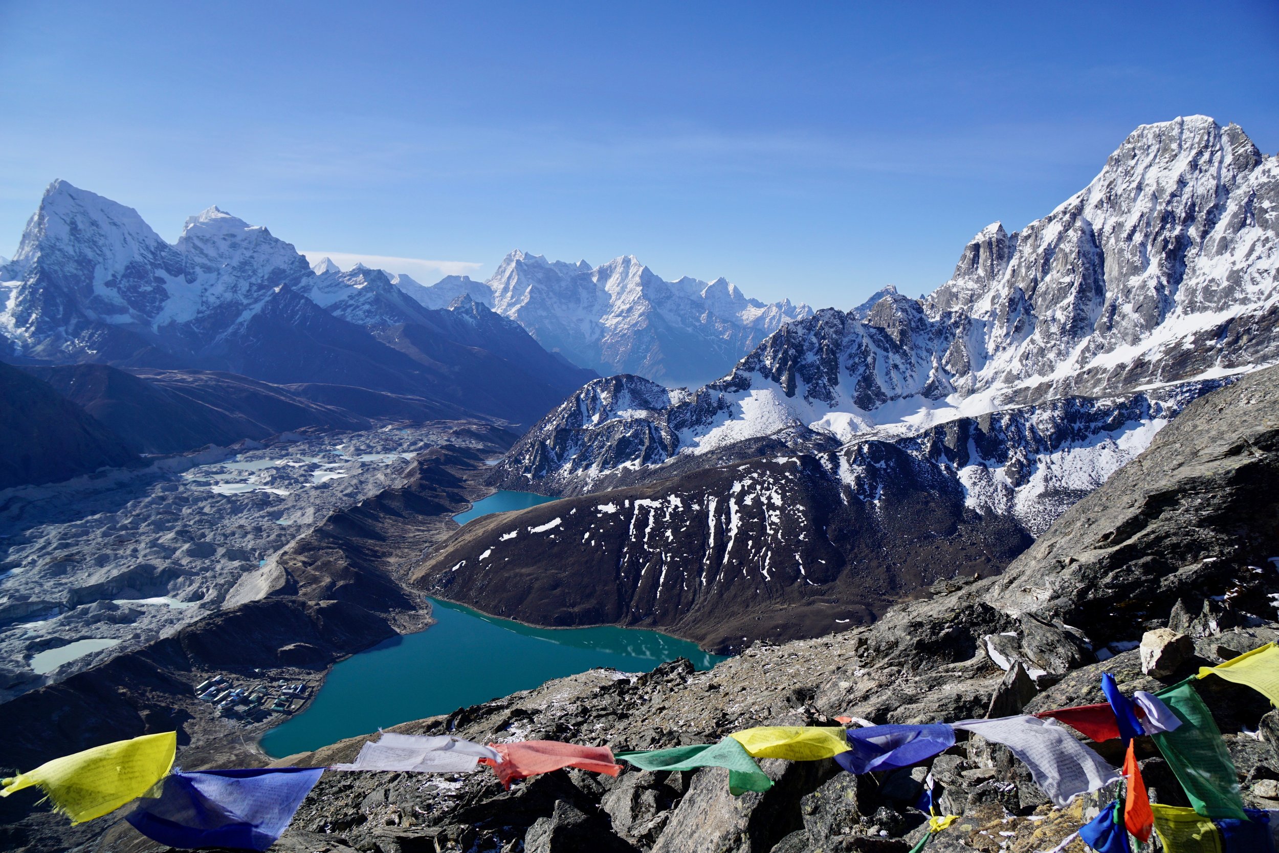
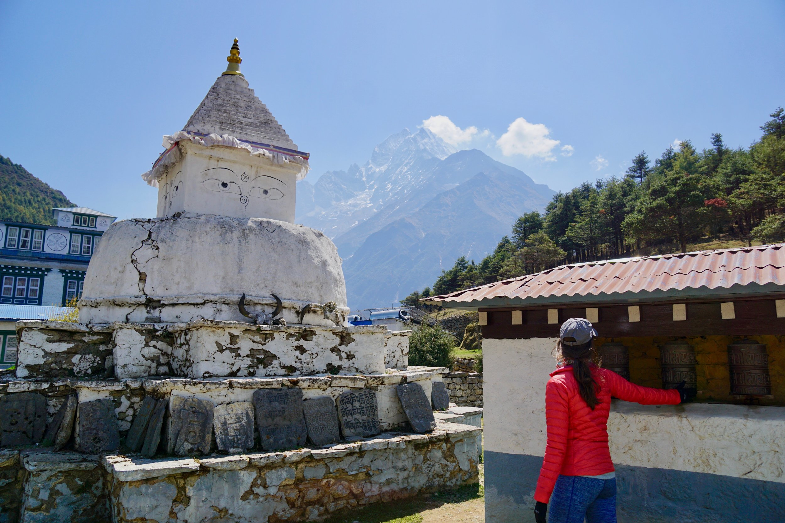
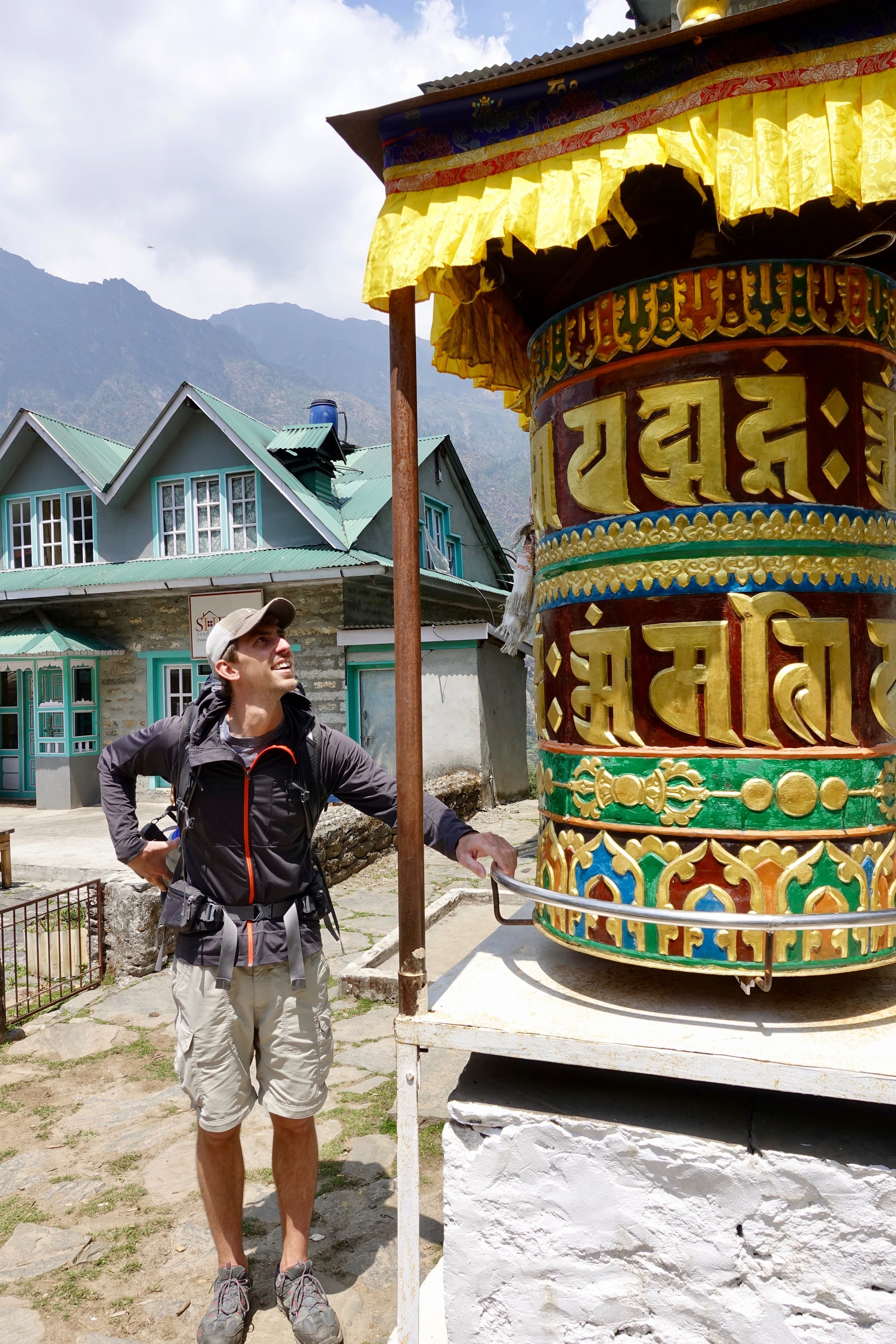
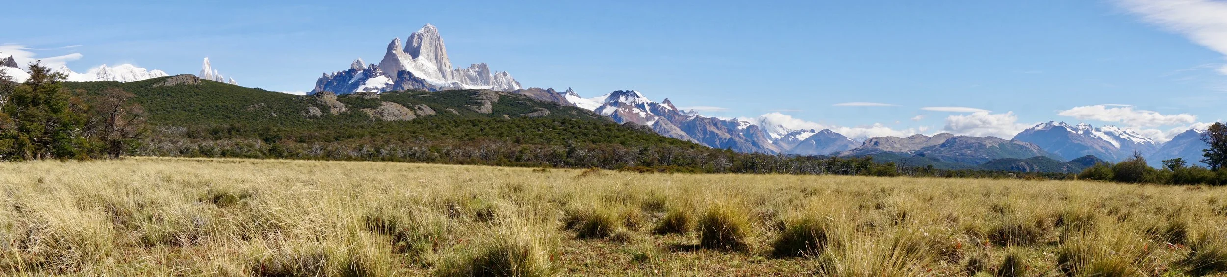
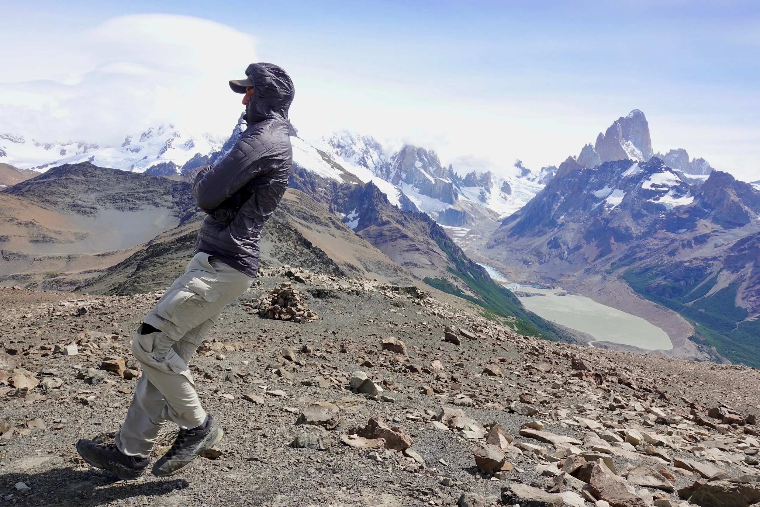
Once on the trail, we quickly started to experience things that online research had prepared us for: 1) When you approach a wall of carved stones in the middle of the trail, that’s a “Mani wall” and should be passed to the left. 2) When you see a colorful drum with bright paintings and mantras--Mani wheel---spin it clockwise. And lastly, 3) When faced with a yak, horse, or creature bigger than you, stand on the hillside of the trail, not the cliff side.

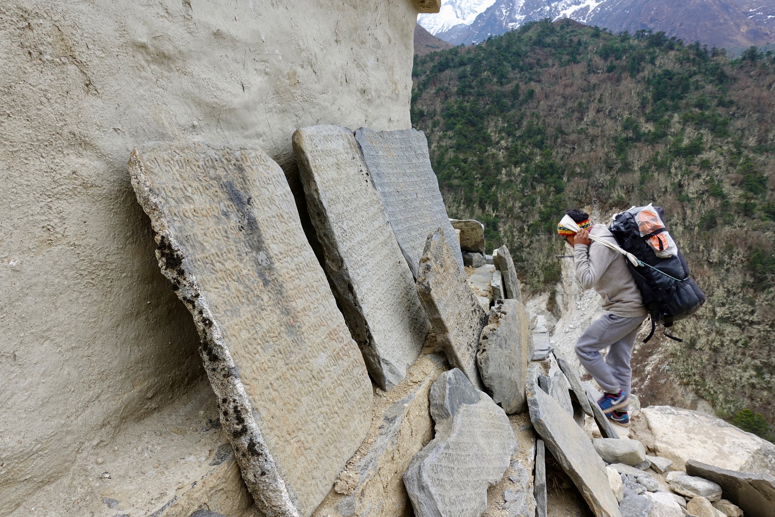
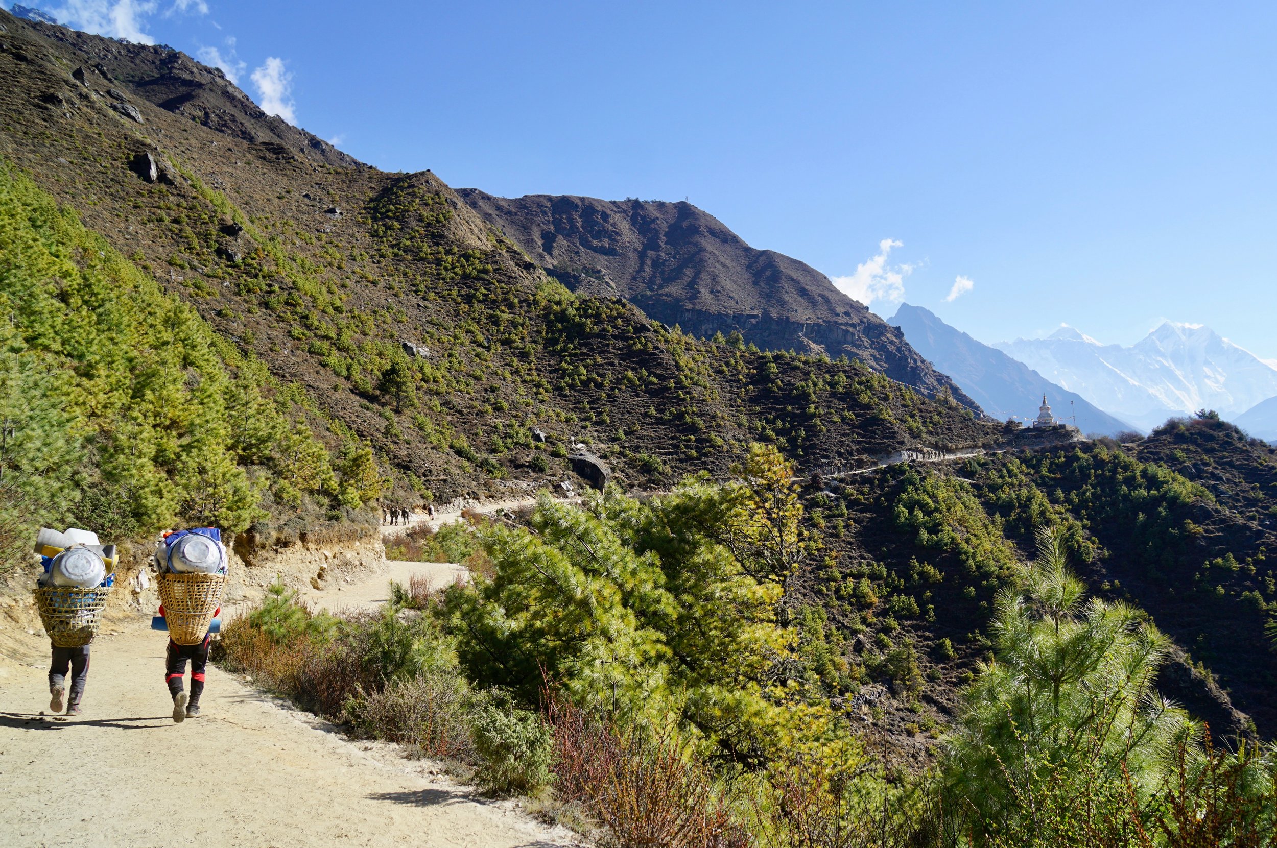
Along the way, we slowly passed porters carrying large loads up the mountain. Kids no older than twelve were carrying massive loads of toilet paper and lighter weight provisions while grown men were carrying cases upon cases of drinks and canned goods. Some loads were well over 100lbs.

Coming the other direction on the trail were small and large groups of people heading back to Lukla; most looked exhausted and as if they hadn’t showered for more than a week. We assumed they had been in the mountains for as long as we planned to be and wondered if the look they were wearing was guaranteed for us in the future.

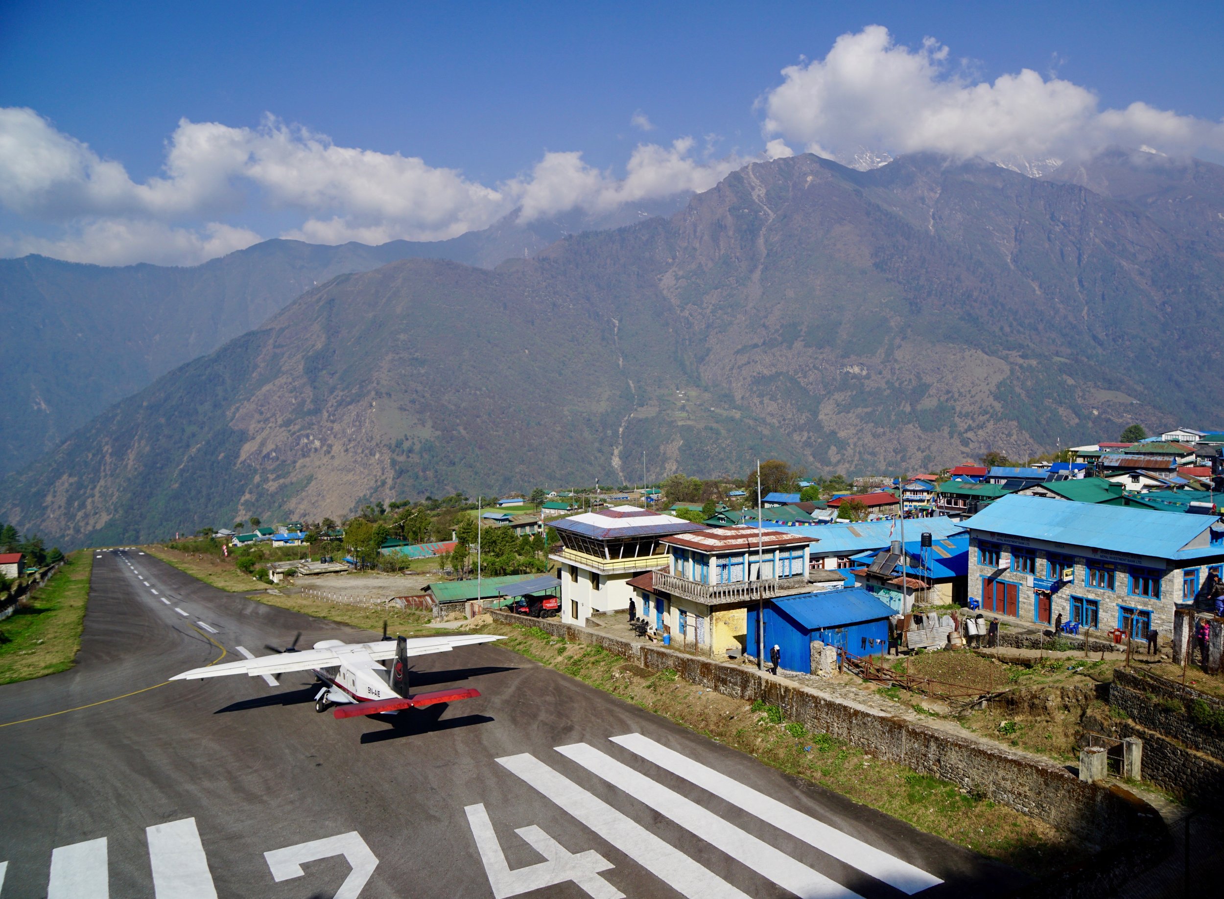
Our first day was fairly straightforward. Three hours of [net] downhill hiking from Lukla to a village named Phakding where we’d have lunch and if we were feeling strong, would continue on for another three hours to the village of Monjo.

We arrived in Phakding in good time and found a lodge for lunch. I order the "dal bhat" and Kimberly ordered a soup and sandwich. Dal (lentils) Bhat (rice) is a staple in Nepal and will be our main dish while here in the Himalayas. All dal bhat is served with a side of vegetable or meat curry. An important fact on the mountain, however, is that most lodges are powered by solar electricity. This means that there is limited refrigeration which in turn means that any meat above the village of Lukla was slowly carried up on a porter’s back. As a result, it will to be a ‘vegetarian only’ diet for us for the next two weeks. As a bonus though, there are refills on dal bhat so you never leave hungry.

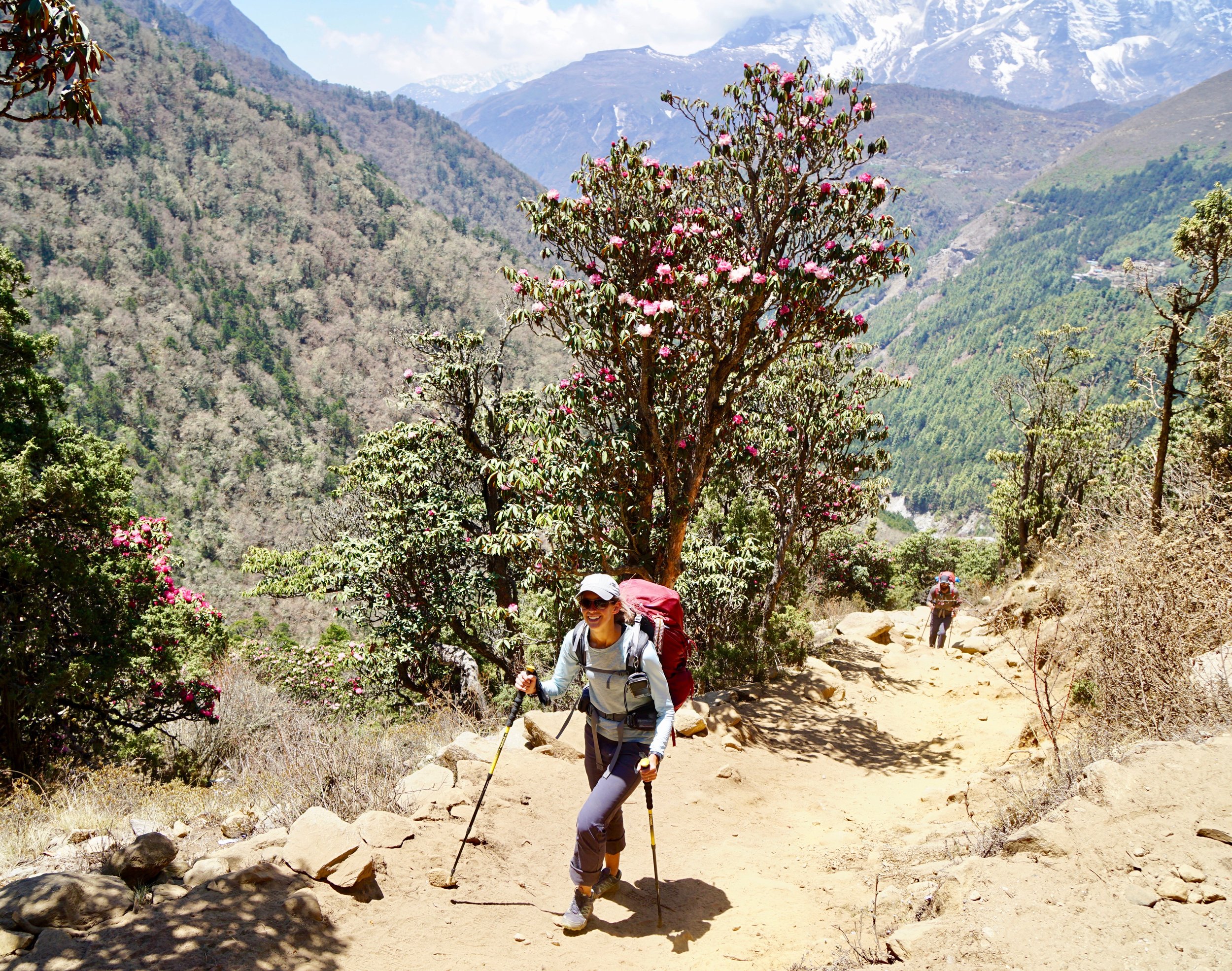
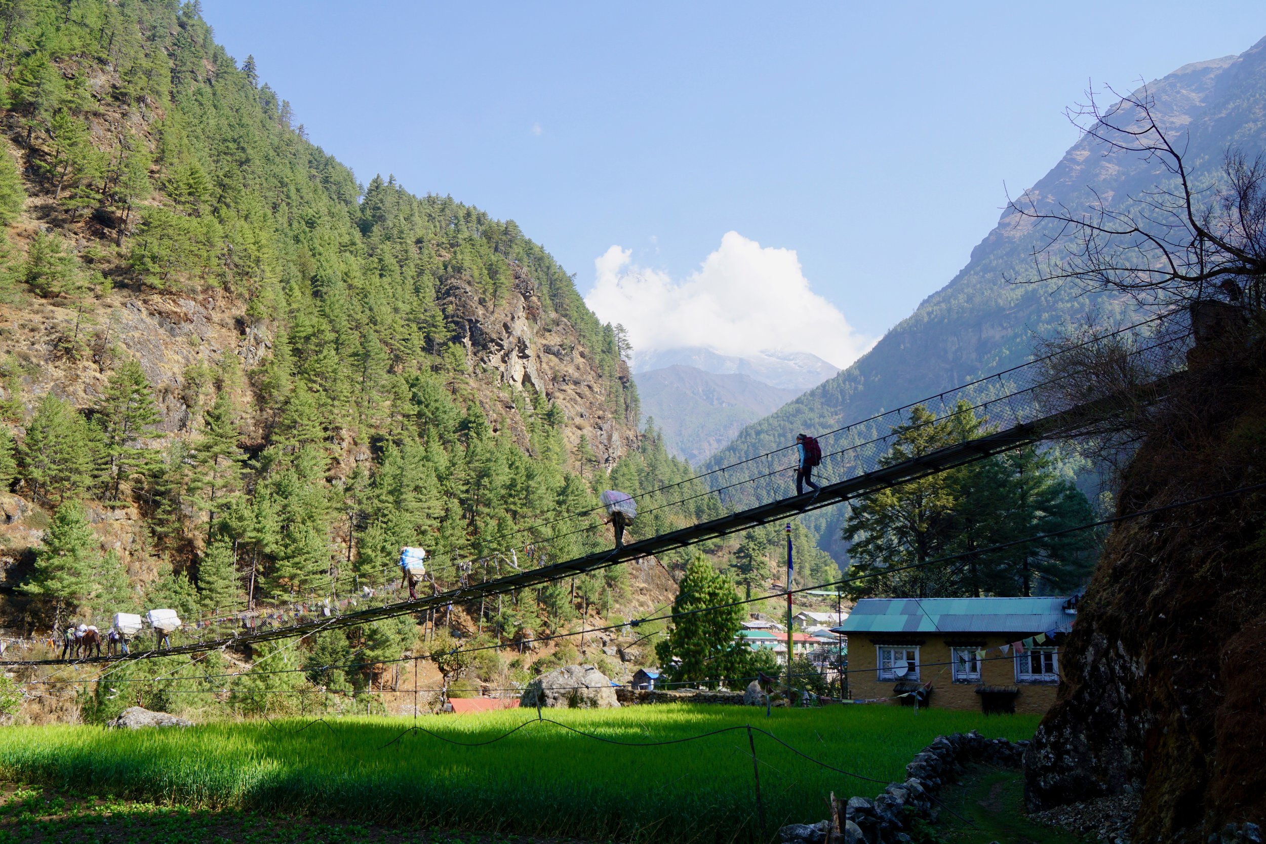
The trail to the village of Monjo was rolling and uneventful; equal parts up and down with the occasional porter or herd of yaks to avoid. About an hour after lunch, it started to rain. Luckily, we were near the village of Bengkar, so we decided to wait out the storm in a quiet and colorful teahouse. Some journaling, a quick power nap, and a $3.50 soda passed the time until the rain subsided.

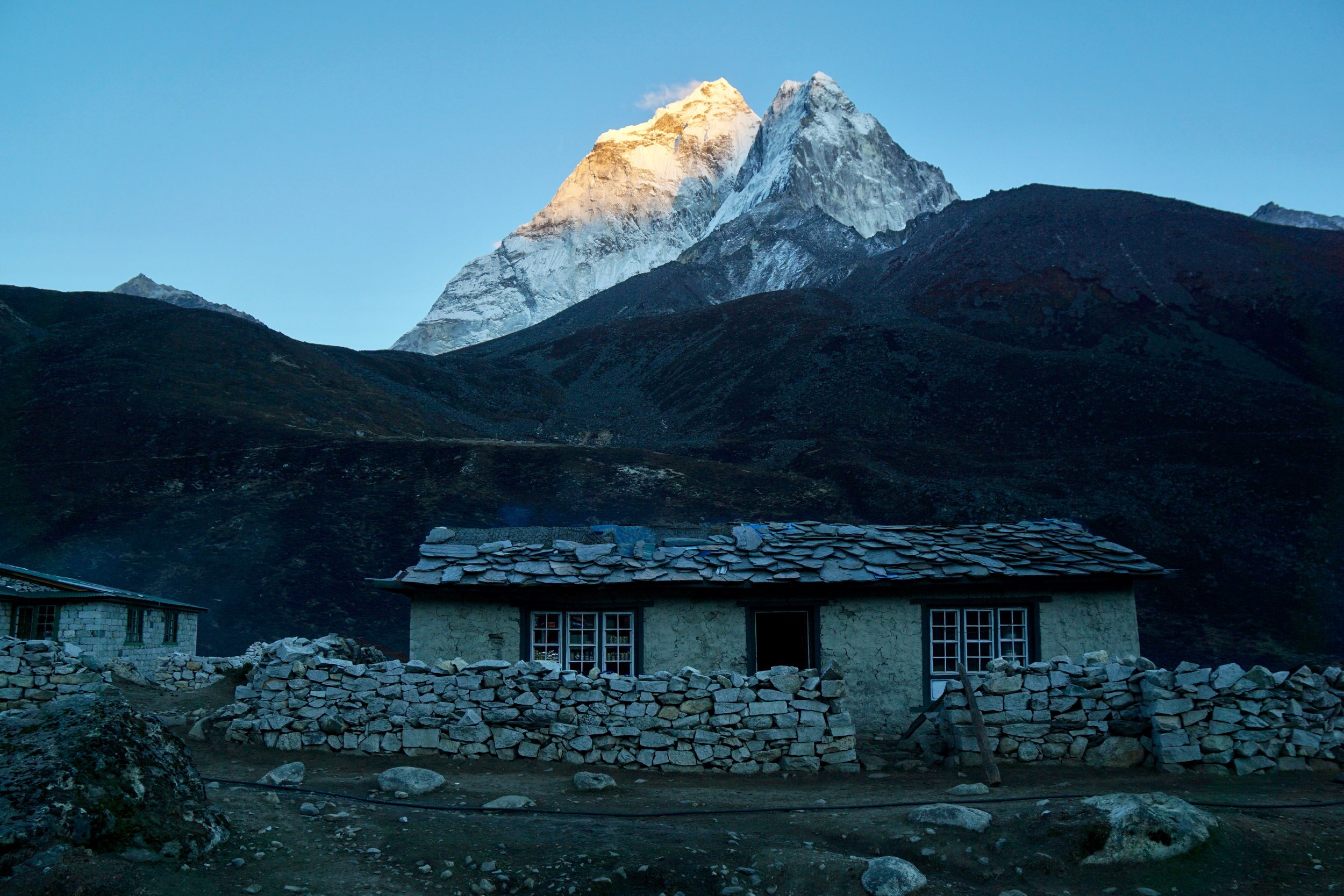
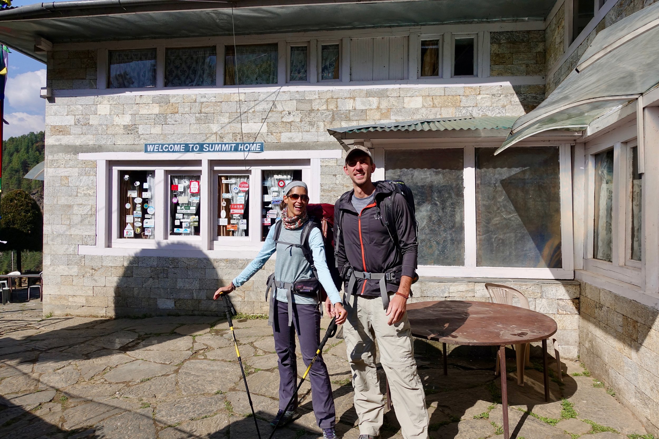
When we arrived in Monjo, a lot of the unknown and anxiety of the first day quickly went away. We were three hours “ahead” of our proposed itinerary and we felt strong and healthy. Walking through Monjo, we used our new method for finding a good place to stay--a method honed by our experience hiking in Annapurna: 1) Smoke is coming from the kitchen chimney and 2) other trekkers are warming themselves by the central wood stove. Simple but effective.

Day Two - Monjo to Namche Bazaar

After a great night’s rest, we shared a bowl of porridge and two boiled eggs for breakfast. During our meal, we met two older gentlemen hiking together, one of whom was from South Africa, so we had a lengthy chat about his country and our time enjoyed there.

In no rush, we packed up our bags and set off for our three-hour hike to our next overnight village, Namche Bazaar. As we followed the trail, we ran along a river before coming to a fork in the road. At the fork, the left trail went low and followed the river and the right headed seemingly parallel but uphill. I consulted our Maps.Me offline app and discover both in fact run parallel and end at the same place. Kimberly wanted the uphill option because there was a faint, spray-painted arrow on a rock nearby directing her that way. I argued for the along-the-river route for it’s scenery and seemingly more flat approach. As we take the lower, we start to run into heavy traffic coming in the opposite direction and Kimberly pointed out that her arrow back at the fork might have been for traffic control. I point out the dozen or so porters also going our direction. The argument is dropped as we realize conserving breath as the air thins is more important.

Outside our first teahouse/lodge in Monjo. Start of Day Two.

Outside our first teahouse/lodge in Monjo. Start of Day Two.

We join back with the singular trail and were immediately greeted with a notorious suspension bridge crossing. Spanning hundreds of feet across two ridgelines and equally as high above the icy glacier river below, the cable bridge with pieced together chain-linked fencing sways and bounces with every step. Hundreds of prayer flags attached to the bridge give you an odd sense of security but the rush of adrenaline as you inevitably look down overrules all emotion.

Crossing the large (and very high) suspension bridge near Namche Bazaar

Crossing the large (and very high) suspension bridge near Namche Bazaar

All trekkers must have two pieces of paper for access on the trails. First is a TIMS (Trekkers Information Management System) Card which acts as a digital record of your itinerary. If you were to go missing in the park, the police could narrow down …

All trekkers must have two pieces of paper for access on the trails. First is a TIMS (Trekkers Information Management System) Card which acts as a digital record of your itinerary. If you were to go missing in the park, the police could narrow down your location based on your last TIMS checkpoint. The second required document is a Sagarmatha (Everest) National Park permit. The majority of the park permit fee goes directly to the villages for improvements to trails, water management, and other needs.

Our first real physical challenge of our trek shortly followed as we were forced into a 1,200ft climb with just over a mile remaining. The climb and trail itself is easy but we’re now above 10,000ft and breathing becomes slightly labored--especially with full packs. Upon arriving in Namche Bazaar, our TIMS (Trekker’s Information Management System) Cards and Sagarmatha National Park permits were checked for the third time and we were welcomed into the unofficial capital of the Himalayas.